Several weeks ago Kaela and I grabbed Obee and headed for the hills to get a day away from the city. Our first stop was the ridge overlooking the North Fork of the American River just below Lake Clementine.


Recently I purchased an adapter ring which allows me to use my old Canon bellows on my new camera. For macro work I use my old 50MM Canon lens with a reversing ring so the lens is attached backwards on the front of the bellows. This allows me to access the levers to set the F stop for control of the depth of field. It has been several years since I shot film with my old Canon F1 and I forgot how to release the stop lever. My first attempts at macro with the new setup suffer from a narrow depth of field due to a nearly wide open aperture. I have since figured out the trick to unlock the lever so things will improve in the future.
The florets in this, the first of three macro photos, are each about the size of the head of a pin.

The florets in this, the first of three macro photos, are each about the size of the head of a pin.


To give a demonstration of scale - one of the pink flowers and the leaves can be seen at the tip of my boot.


Kaela caught me getting the shot with her iPod


Another small flower shot without the bellows.


Manzanita flowers.


No photo shoot is complete without at least one old rusty thing!


Soon we find ourselves on the ridge over the Middle Fork of the American River - the river lies far below.


Looking west - downstream - through the canyon.


Looking east towards the Sierra Nevada and our destination - Placer Big Trees to sit beneath a giant Sequoia or that snow in the distance, whichever comes first.


A couple of shots of the road twisting down into the canyon.


Nearing the bottom of the canyon we get a good view of an oxbow in the river.


The bridge over the North Branch of the Middle Fork of the American River.


Downstream from the bridge.


The river washes over veins of quartz below the bridge.


Next we head up the road on the south side of the canyon, back up to the next ridge.


Along the south side.


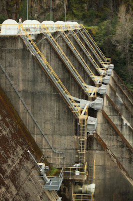
Over the ridge and down into the next canyon we find Ralston Reservoir


and the dam at the reservoir

An eagle soars above a ridge over Ralston.


Ridgetop trees silhouetted against broken clouds.


Several years ago a fire raged through the area leaving many trees skeletons.


Finally we reach the snow and a closed road about 5 miles short of our destination.


Obee had much more fun tossing his ball into the snow then digging it back out...


than in actually bringing it back to us.


Sculpted by wind, rain and warm temperatures a snow face looks over the forest.


We get one last look of the canyon as we return at the end of the day.


